
Built to spec
Built to your engineered drawings, survey, and the real site conditions, not a one-size-fits-all approach forced to fit.
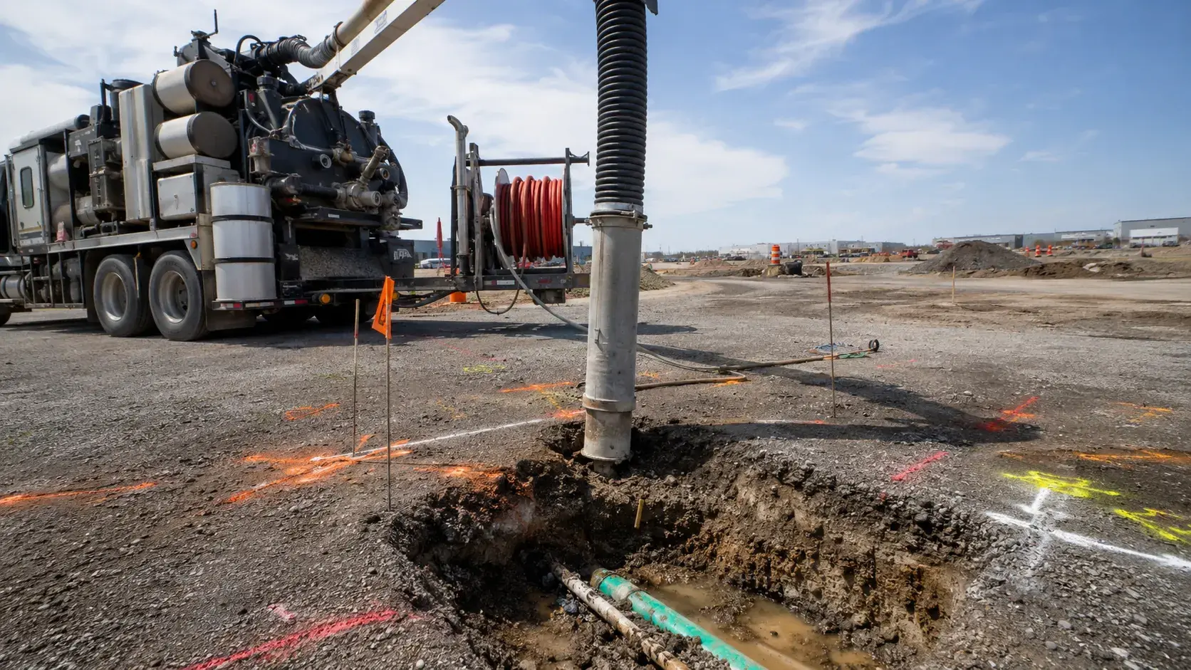
Utility Locating and Daylighting in Bradford West Gwillimbury finds and exposes buried utilities safely before excavation using locating and hydrovac.
Tell us what you need and we’ll get you a quote.
Licensed, insured & WSIB-covered · Free, no-obligation quote & on-site assessment.
Built to your engineered drawings, survey, and the real site conditions, not a one-size-fits-all approach forced to fit.
Durable materials and methods chosen for the load, traffic, and environment on site.
Send specs, drawings, or photos and get a free, no-obligation site visit and estimate with no guesswork.
Installation and site work completed in accordance with Ontario requirements.
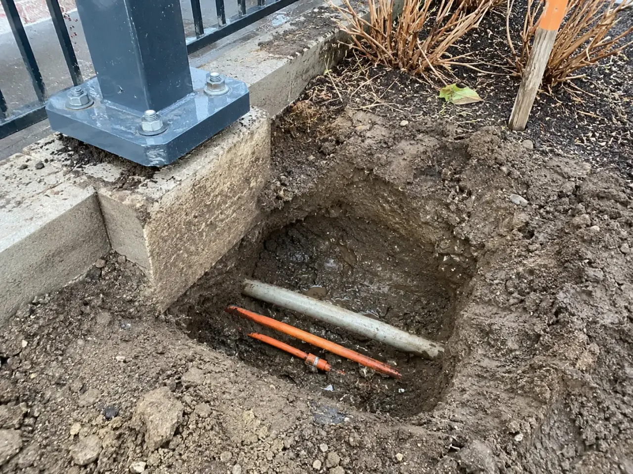
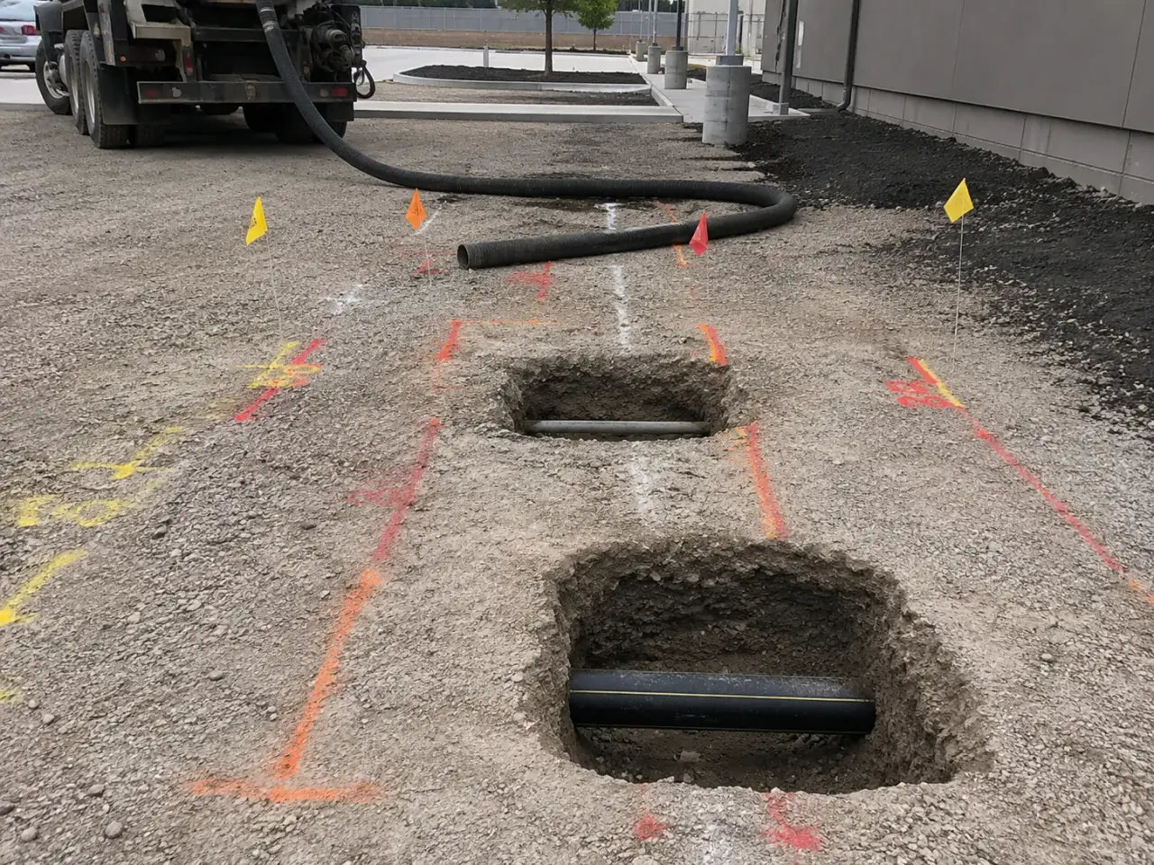
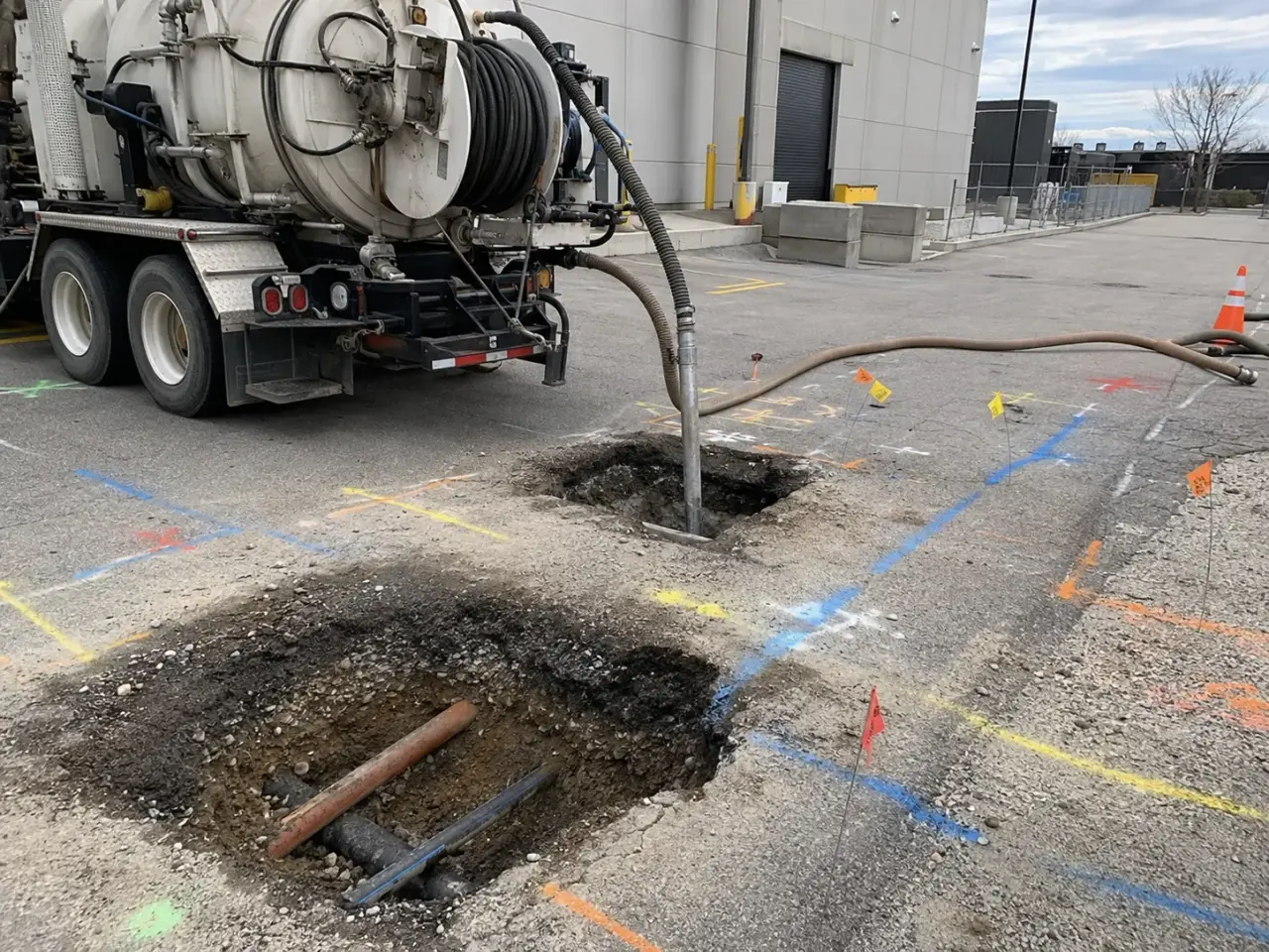
Electromagnetic locating traces conductive lines or sondes where a usable signal can be applied. Ground-penetrating radar detects contrasts that can indicate utilities and disturbed ground but does not identify every target reliably. Records, surface features, acoustic methods, drain cameras, and survey provide supporting evidence. Vacuum daylighting then exposes critical utilities with controlled air or water excavation. No single method turns an unknown subsurface corridor into certainty.
Step 1,
Step 2, First, we review the civil drawings, available as-builts, owner records, proposed grading, bore profiles, and locate responses. We walk the site for hydrants, valves, pedestals, transformers, meters, cleanouts, patched pavement, building entries, and other evidence of buried systems. Public locate responses and their ground markings are reconciled with the paperwork. On campuses, plants, yards, and development parcels, we also trace private electrical feeds, communications, fire lines, process lines, lighting, irrigation, and site drainage that public members do not necessarily mark.
Step 3, Electromagnetic equipment traces a conductive line directly through a connection point or indirectly from the surface. Passive sweeps look for energized power and radio signals, but a passive response alone does not identify an asset. Ground penetrating radar can identify subsurface contrasts and non-conductive features, subject to soil conductivity, reinforcement, moisture, depth, and surface access. We compare methods instead of treating one instrument response as final proof.
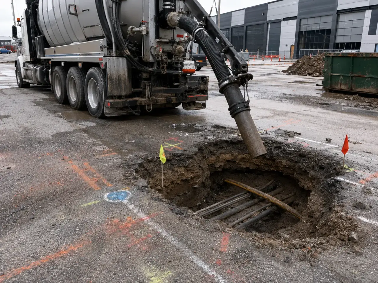
Step 4, For daylighting, we establish traffic and work-zone controls, confirm the current marks, and position the hydro excavation unit so hoses and the boom do not create a new conflict. A focused water lance loosens soil while the vacuum removes slurry into the debris tank.
The operator reduces energy around the anticipated asset and works progressively across the mark to reveal its edges. We expose enough of the utility to identify its direction and crown elevation without undermining it. Spoils do not fall back onto the asset, and exposed services are supported when the excavation or duration requires it.
Step 5, We photograph the opening with a scale, capture measurements against the project datum or survey control provided, and label uncertainty honestly, such as an unverified duct bank edge or an apparently abandoned pipe. The hole is then protected for inspection or backfilled with specified material in controlled lifts. Pavement, granular base, concrete, or landscaped surface restoration follows the project detail.
Planning utility locating and daylighting in Bradford? Talk it through with our team.
No. A locate identifies the indicated horizontal position of member-owned infrastructure, but it does not physically prove depth, outside diameter, material, or exact alignment at a crossing. Harrowgate daylights the target where the design or excavation needs three-dimensional certainty, while keeping the locate package and ground markings current.
Not necessarily. Infrastructure inside an industrial plant, commercial campus, yard, or development parcel may be privately owned and absent from public locate responses. Harrowgate scopes a private-site investigation using records, site evidence, electronic tracing, radar where suitable, and daylighting so unregistered power, communications, fire, process, and drainage lines are addressed.
No. Ontario guidance treats hydrovac daylighting as excavation. Valid locates and the required responses must be in place before soil removal begins. Harrowgate checks the paperwork against the surface marks and site evidence, then resolves missing, expired, or conflicting responses before positioning the unit and opening a test hole.
We record the test-hole location, date, target identity, visible material, apparent diameter, utility direction, crown or other specified elevation, measurement reference, surface condition, photographs, and locate reference. Where the project supplies survey control, the exposure can be tied to that datum so engineers can compare it directly with the proposed profile.
Radar is useful when a buried feature is non-conductive, when tracer wire is unavailable, or when a broader subsurface sweep is required. Performance depends on soil conductivity, moisture, reinforcement, depth, target size, and surface access. Harrowgate treats radar responses as interpreted evidence and uses targeted exposure for final confirmation.
The opening must expose enough of the target to identify both edges, direction, condition, and the specified measurement point without removing unnecessary support. Size changes with depth, congestion, soil, asset diameter, inspection needs, and whether a connection follows. Harrowgate plans each hole around the information and safe access the project actually requires.
After documentation or inspection, Harrowgate places specified backfill around the asset without voids or impact, compacts subsequent lifts, and reinstates the surface to the contract or road authority detail. Road openings can require engineered fill, granular base, temporary asphalt, and final paving. Slurry is contained and taken to an approved receiving location.
No. Marks indicate an interpreted utility position within the limits of records, access, signal, equipment, and site conditions. Critical crossings and congested areas are exposed or otherwise verified as the project requires before mechanized excavation proceeds.
Daylighting is used where actual depth, material, size, orientation, clearance, or condition controls excavation, drilling, shoring, foundation, or connection work. It is especially valuable at crossings, parallel congested corridors, changes in direction, and places where records disagree.
Still have a question about utility locating and daylighting in Bradford? Ask our team directly.
Commercial and heavy-civil construction delivered for developers, contractors, property managers, and municipalities.
Send drawings, a site plan, or a description of the scope. Harrowgate Group is licensed, insured, and WSIB-covered.
Licensed, Insured & WSIB-Covered, work managed and documented on every job
Tell us what you need and we’ll get you a quote.
Harrowgate Group provides utility locating and daylighting, delivered and installed with quote-ready support across Toronto and surrounding Ontario communities.
Companies We've Worked With
Harrowgate Group delivers commercial and heavy-civil construction for developers, contractors, institutions, municipalities, and property groups across Ontario.
 Popeyes
  Tim Hortons
  Subway
  University of Toronto
  Madison Group
  RioCan
  Women's College Hospital
  Starbucks
  Mazda
Mazda  TD Bank
  City of Toronto Popeyes Tim Hortons Subway University of Toronto Madison Group RioCan Women's College Hospital Starbucks Mazda TD Bank City of Toronto