
Built to spec
Built to your engineered drawings, survey, and the real site conditions, not a one-size-fits-all approach forced to fit.
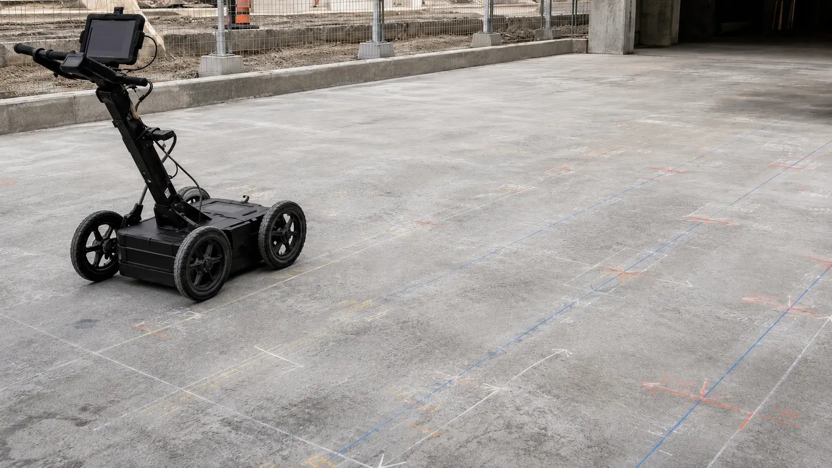
GPR Concrete Scanning in Orillia uses ground-penetrating radar to locate rebar, conduit, and voids before cutting or coring concrete.
Tell us what you need and we’ll get you a quote.
Licensed, insured & WSIB-covered · Free, no-obligation quote & on-site assessment.
Built to your engineered drawings, survey, and the real site conditions, not a one-size-fits-all approach forced to fit.
Durable materials and methods chosen for the load, traffic, and environment on site.
Send specs, drawings, or photos and get a free, no-obligation site visit and estimate with no guesswork.
Installation and site work completed in accordance with Ontario requirements.
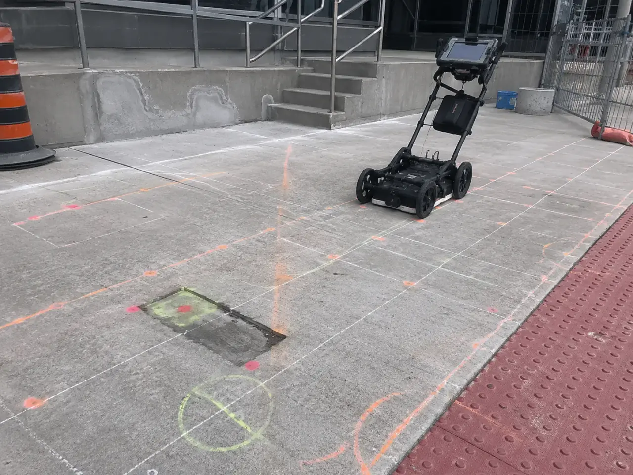
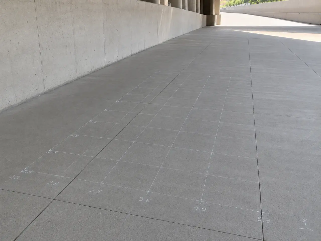
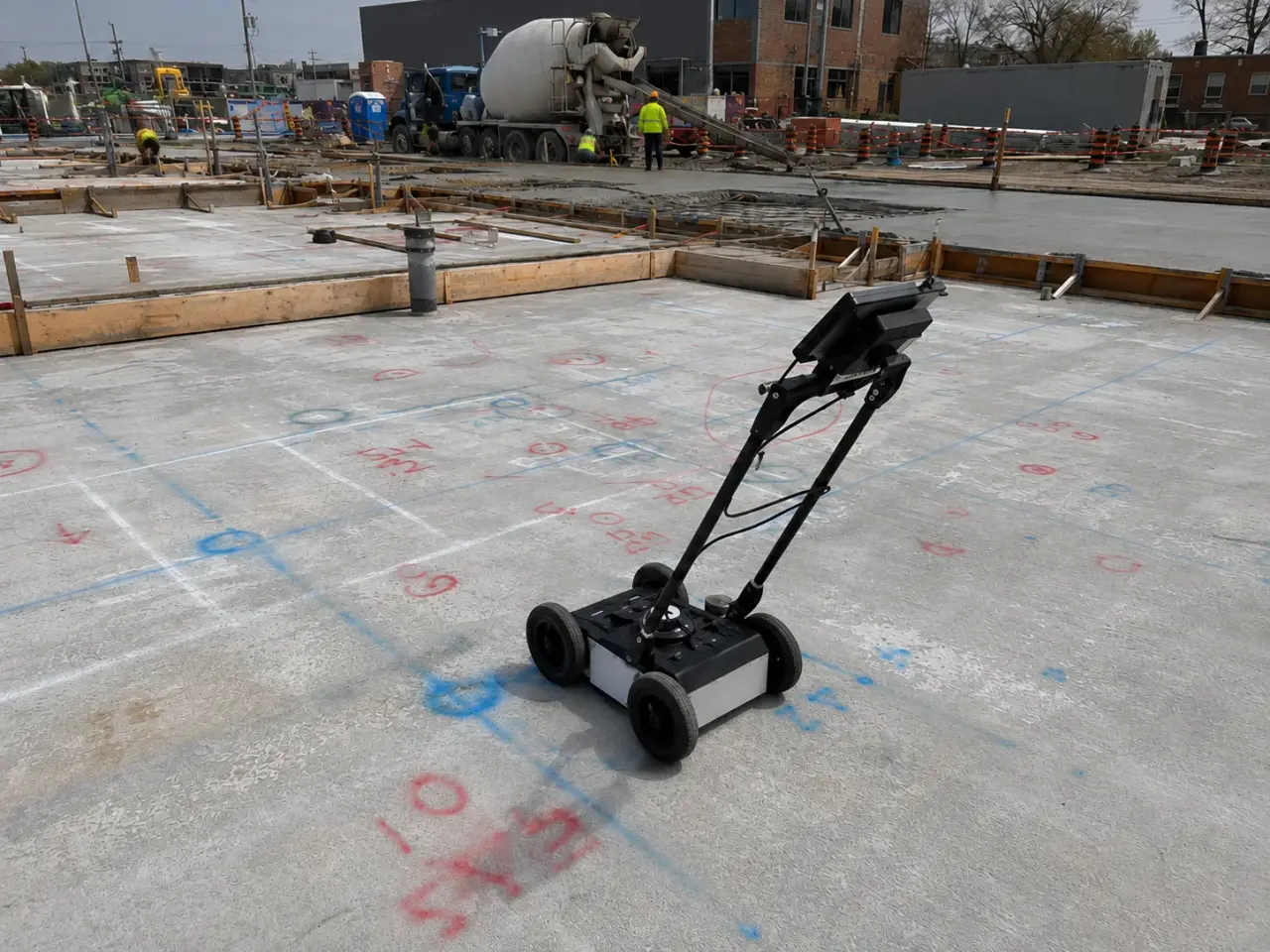
Two-dimensional line scans, orthogonal grid surveys, area mapping, depth estimation, and combined GPR, electromagnetic, X-ray, or exploratory methods serve different target and access conditions.
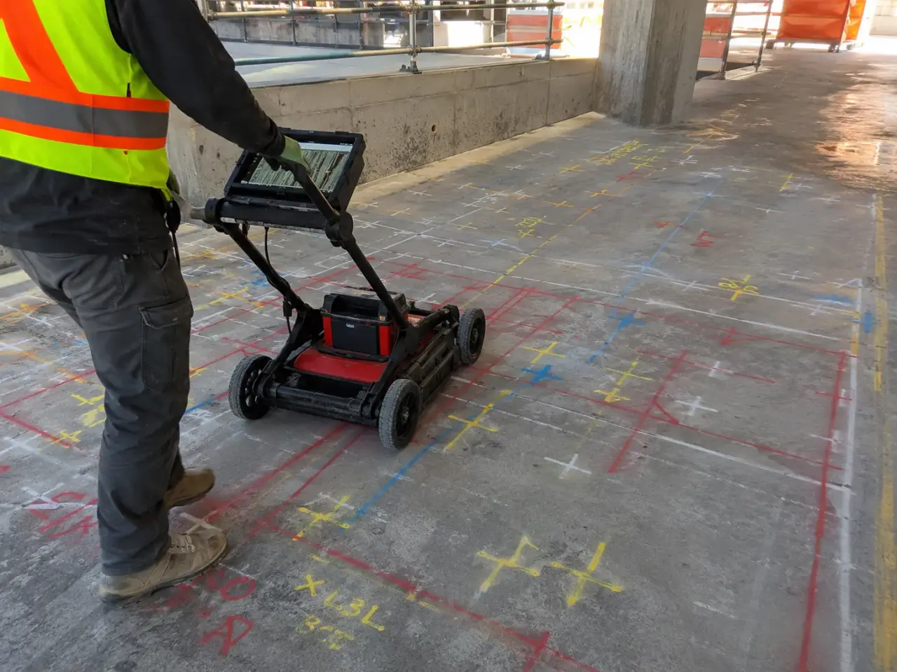
Step 1, We define the proposed work zone and required depth, establish a grid, calibrate to known thickness where possible, scan in two directions, mark target centres and uncertainty, then review conflicts with the cutting or anchor layout before work proceeds.
Step 2, Work stage 1. The request identifies hole diameter, cut depth, anchor pattern, member type, accessible faces, and suspected services. A vague request to scan a slab is converted into marked work zones around actual proposed penetrations.
Step 3, Work stage 2. The surface is cleaned and a measured grid is established from permanent references. Drawings, visible conduits, junction boxes, drains, beams, tendons, and prior openings guide the survey plan.
Step 4, Work stage 3. Parallel passes collect data in one direction, then perpendicular passes distinguish linear targets and intersections. Tight spacing is used around congested reinforcement, slab bands, beams, or post-tensioned zones.
Step 5, Work stage 4. Hyperbola response, continuity, depth estimate, amplitude, and pattern are interpreted in real time. Top and bottom steel mats, conduits, and tendon bands are marked with different colours or labels.
Step 6, Work stage 5. Potential conflicts are transferred to the proposed core or anchor template. The layout is shifted only within designer-approved limits, and areas with unresolved risk are escalated for another method or selective opening.
Step 7, Work stage 6. A scan record includes grid location, surface references, equipment, accessible face, estimated depth, marked targets, limitations, and photographs so the field markings remain useful after the operator leaves.
Planning GPR concrete scanning in Orillia? Talk it through with our team.
Scanning supports construction under the Ontario Building Code and applicable CSA structural design requirements, but it does not replace engineering approval or utility isolation. Work planning also follows Ontario construction safety requirements for energized systems, drilling, cutting, access, and hazard assessment.
Control point 1. A high-frequency concrete antenna gives useful resolution in typical slabs but has limited depth. Lower-frequency equipment penetrates farther with less detail. Antenna and scan spacing are selected for member thickness and target size.
Control point 2. Depth is estimated from radar-wave velocity in concrete. Moisture, aggregate, and density change velocity, so known slab thickness, exposed bars, or test measurements improve calibration.
Control point 3. Closely spaced reinforcing can mask deeper conduits or the lower mat. Scanning from both faces, changing orientation, and supplementing with electromagnetic locating improve confidence where access permits.
Control point 4. Plastic pipe with no contents may produce a weak response, while air or moisture around it can produce a strong interface. Target identity is inferred from pattern and context, not radar colour alone.
Control point 5. Post-tensioning receives a no-cut control zone set by the structural engineer. GPR mapping is combined with tendon drawings, stressing-end observations, and other verification before any intrusive work.
Control point 6. Field markings are protected and tied to photographs and dimensions. If the work layout changes, the new zone is scanned rather than extending conclusions beyond the surveyed grid.
GPR can map reinforcing bars, welded wire, post-tensioning patterns, metallic and some non-metallic conduits, slab thickness changes, and selected void or delamination responses. Detection depends on depth, size, moisture, congestion, orientation, and access. Harrowgate reports likely target type and limitations rather than presenting every radar reflection as positively identified.
Useful depth depends on antenna frequency, concrete moisture and conductivity, reinforcing congestion, target size, and access. High-frequency antennas resolve typical slab reinforcement well but do not see indefinitely. We select equipment for member thickness, calibrate where possible, and state the reliable scan zone. Deeper or masked areas need supplementary methods.
Sometimes pattern, spacing, continuity, depth, drawings, and nearby boxes support a reasonable interpretation, but radar alone does not label material. Rebar usually forms regular mats, while conduits follow service routes. Harrowgate combines orthogonal scans, electromagnetic locating, records, and isolation. High-consequence targets may require both-face scanning or controlled exposure.
No. GPR is one part of a post-tension risk process. Tendon drawings, stressing-end locations, member geometry, scans in both directions, engineer-defined exclusion zones, and sometimes other verification are required. Tendons are not drilled, cut, or exposed because a single scan line appears clear. The structural engineer approves the final opening location.
A linear target produces its clearest crossing response when the antenna travels across it. A pass parallel to the target can be weak or misleading. Orthogonal grids reveal both reinforcement directions, improve continuity tracking, and help distinguish intersections. Tight grids are used around proposed holes so the safe layout is based on complete coverage.
No. A clear result applies only to the scanned area and reliable depth and is limited by congestion, material, access, and equipment. Small plastic conduits, deep services, or targets below dense steel can be missed. Harrowgate combines scan results with drawings, isolation, depth stops, observation, and stop-work rules for unexpected resistance.
The record identifies the scanned grid and permanent references, proposed work, accessible face, equipment, target markings, estimated depths, photographs, limitations, and unresolved conflicts. It links field marks to the approved penetration or anchor template. If the layout or depth changes, the affected area is rescanned rather than relying on an old general survey.
No. It detects dielectric contrasts and patterns; reinforcement, conduits, voids, moisture, layering, and other features can look similar without drawings or corroboration.
No. Depth, congestion, access, calibration, material, equipment limits, and non-detectable targets create uncertainty. The approved drilling plan retains safe margins and other controls.
Still have a question about GPR concrete scanning in Orillia? Ask our team directly.
Commercial and heavy-civil construction delivered for developers, contractors, property managers, and municipalities.
Send drawings, a site plan, or a description of the scope. Harrowgate Group is licensed, insured, and WSIB-covered.
Licensed, Insured & WSIB-Covered, work managed and documented on every job
Tell us what you need and we’ll get you a quote.
Harrowgate Group provides gpr concrete scanning, delivered and installed with quote-ready support across Toronto and surrounding Ontario communities.
Companies We've Worked With
Harrowgate Group delivers commercial and heavy-civil construction for developers, contractors, institutions, municipalities, and property groups across Ontario.
 Popeyes
  Tim Hortons
  Subway
  University of Toronto
  Madison Group
  RioCan
  Women's College Hospital
  Starbucks
  Mazda
Mazda  TD Bank
  City of Toronto Popeyes Tim Hortons Subway University of Toronto Madison Group RioCan Women's College Hospital Starbucks Mazda TD Bank City of Toronto